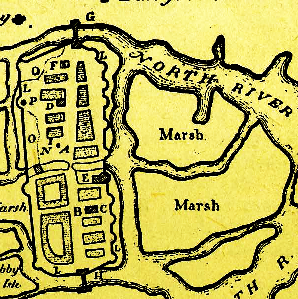
Early 17th century plan of Cork city showing the center of the town lying between North Channel and the South Channel of the River Lee. The plan doesn’t show the northern suburb (Shandon) and the southern suburb around St Finbarr’s Cathedral. the three marshlands were reclaimed by 1760 to provide an extension to the city.
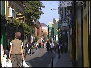
Paul Street, Cork, looking east. This narrow pedestrianised street gives access to the former Harpur’s Lane on the left, just beyond the trees.
One of the consequences of modernization in Ireland is the disappearance of old names from the street-map. Sometimes even the street or lane has vanished with later developments. In Midleton, we’ve lost William Street (perhaps originally named for either King William of Orange or King William IV, the immediate predecessor of Queen Victoria? It’s now called ‘New’ Cork Road), Charles Street (now Connolly Street), Free School Lane (now McDermott Street and Casement Street) and Bridewell Lane (now Oliver Plunkett Street)! The latter seems somehow appropriate since St Oliver Plunkett spent time in prison before being executed.
Other Irish towns and cities have undergone similar processes – anything that smacked of the old regime was removed and a more patriotic name was chosen. Sadly, the motives were not always patriotic – sometimes snobbery intervened (and let’s be honest here, there’s no other way to put it – snobbery is exactly the right word!).
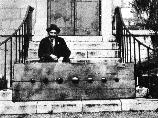
An old photograph from the 1930s showing the local historian Philip G Lee posing in the stocks at St Paul’s Church, next to Harpur’s Lane, in Cork!
Cork city had a fine collection of interesting, even characterful, names! Tom Spalding gives a few in his book Layers: The Design, History and meaning of Public Street Signage in Cork and other Irish Cities. Names such as Beger Man’s Lane (sic), Knocker’s Hole, Crooked Billet, Three-Hatchet Lane (gulp!), Hang Dog Road, Dead Woman’s Hill, and Gunpowder Lane have all vanished – at least as names. The cult of respectability removed some of these names. Knocker’s Hole on lower Shandon became Shandon Castle Lane, then New Chapel Lane and finally ended up as Dominick Street behind the Dominican Priory on Pope’s Quay! At no point did this lane actually undergo any widening process during its name changes! This habit of upgrading the lane without adding any appreciable improvement in amenities or dimensions is not unique to Cork, but sometimes it really does got out of hand.
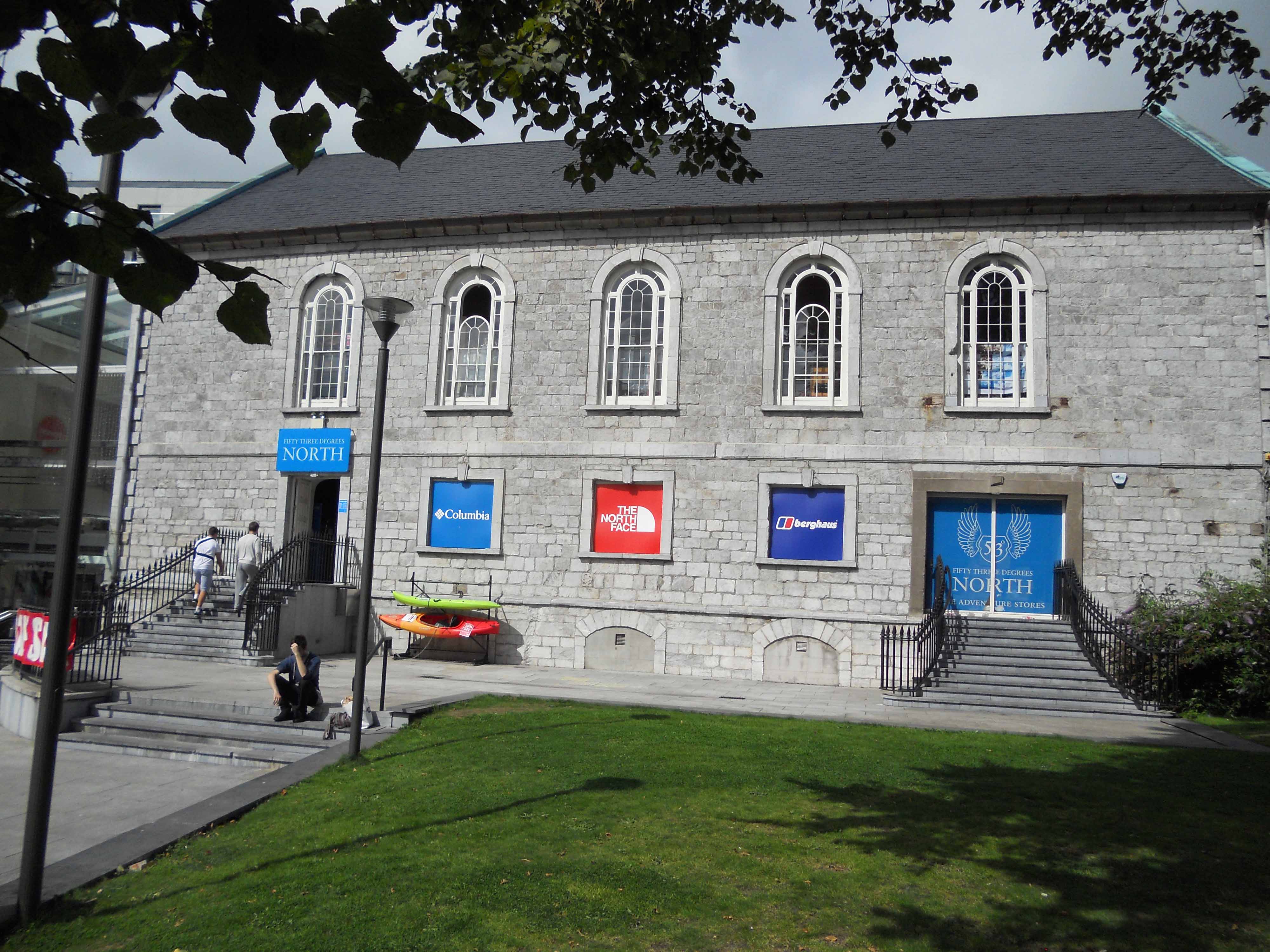
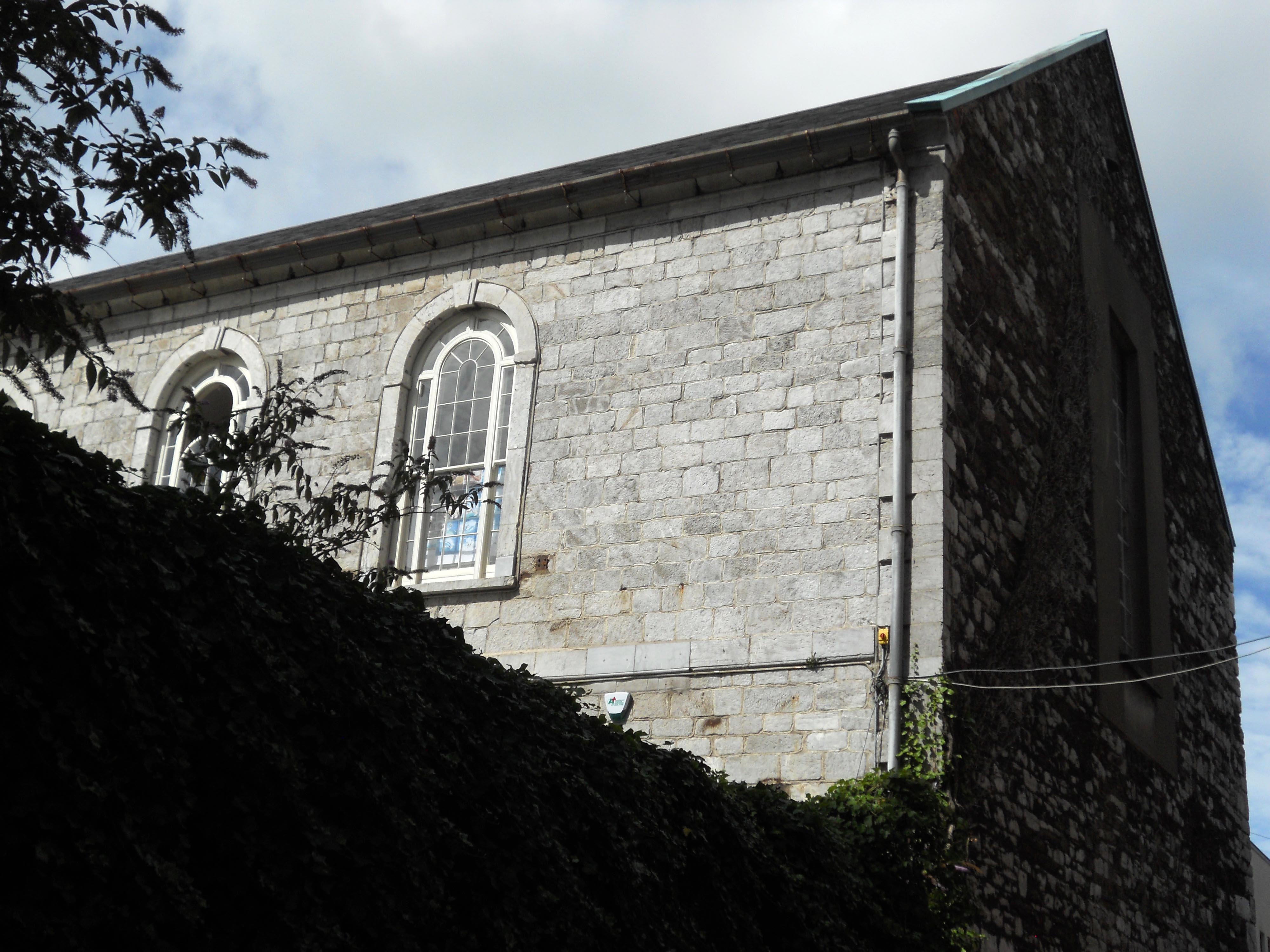
St Paul’s Church, built as an Anglican church between 1723 and 1726, is now deconsecrated and in use as a sports shop! Happily the moulded plaster barrel vaulted ceiling still survives within.
A classic example is Harpur’s Lane or Harper’s Lane in the centre of Cork. This lane, which still exists, but under a different name, is a narrow lane running south to north from Paul Street to the Coal Quay (the OFFICIAL Coal Quay, that is – not the ‘;popular’ Coal Quay which is actually Cornmarket Street!).
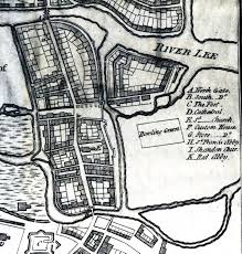
A map of Cork city about 1690 showing the first area of reclaimed land to be built up just to the right of the walled city and above the Bowling Green. This area was later to contain Harpur’s Lane which isn’t shown on the map because it had yet to be laid out.
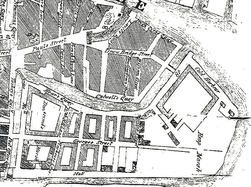
Harpur’s Lane does not appear on a map of the 1690s which is the first to show Cork bursting out of its constricted medieval core and expanding into the marshlands both east and west of the city. The land that would later contain Harpur’s Lane was one of the first areas to be reclaimed in the eastwards expansion of the city. In Carty’s map of 1725 there is a lane on the site, but it isn’t named. St Paul’s Church was built next to the southern end of the land between 1723 and 1726. The name first appears on a Smith’s map of 1750 as Harper’s Lane and it keeps that name until the twentieth century. The southern end of the land was anchored by St Paul’s Church – a plain preaching hall that is now converted into a sports shop!
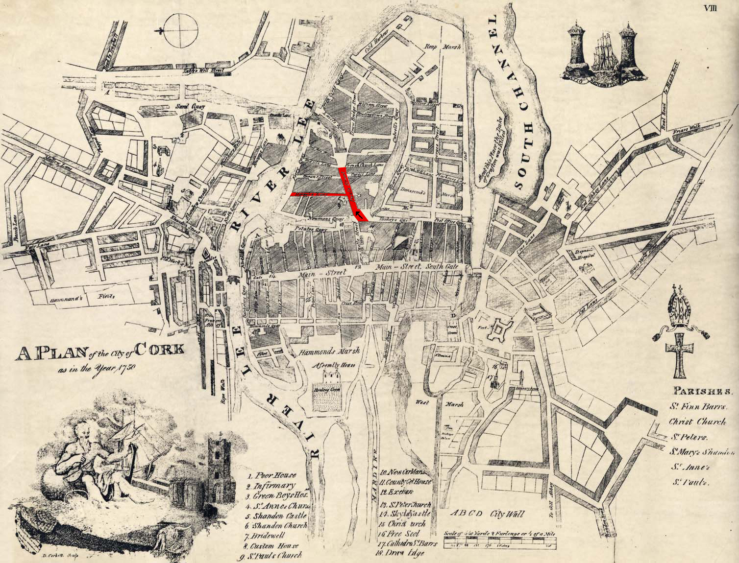
Smith’s map of 1750 shows St Paul’s Street and Harpur’s Lane. The map is oriented so that North is actually to the viewer’s left!
During the 19th century Harpur’s Lane gained notoriety as the site of a soup kitchen during the Great Irish Famine. In 1852 there were questions as to whether Mr Morrough’s disused theatre on the lane would be a suitable place for the casting of ballots during the election – remember that ballots were then cast openly by declaration rather than by being put into a box!
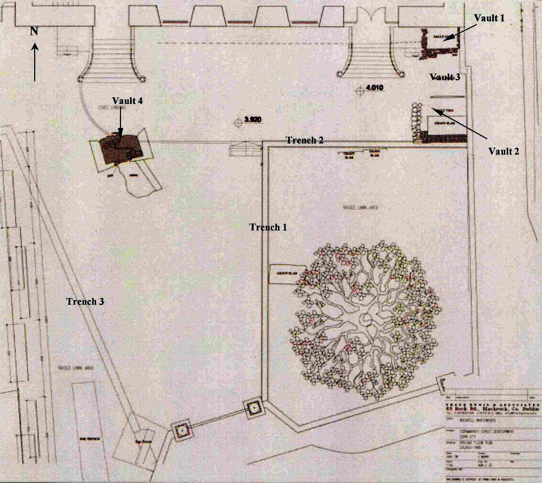
Plan of St Paul’s churchyard with tombs and graves marked in. St Paul’s Street is at the bottom (south) and Harpur’s Lane is immediately to the right of the churchyard.
But Harpur’s Lane sank into the murky underbelly of Cork with a different kind of sleaze. One of the objections to using the old theatre on Harpur’s Lane for ballotting during the election of 1852 was the reputation that the lane had acquired as a haunt of prostitutes – although this was strenuously denied at the time! Port towns were notorious for prostitution – Cork being no exception. Harpur’s Lane became the haunt of ladies of ill-repute who, I understand, may have deprived their clients of their coins by offering intimate services only for the poor client to be knocked up in a different way. The clients were often hit over the head, their purses removed and the wretched men were then disposed of by being dropped over the quay into the north channel of the River Lee. They had been ”shanghaied’!
Cork about 1760 was a city of canals – more like Amsterdam than Venice, despite nineteenth century romantic pretensions. Harpur’s Lane is immediately to the right of ‘Newman’s Quay’ and running parallel to it into Paul’s Street. ‘Newman’s Quay’ was actually Newenham’s Quay! The long curving canal is now covered over and is better known today as St Patrick’s Street – Cork’s main shopping street.
Just before Easter, I was disgusted to find that Harpur’s Lane was ‘improved’ in two ways – first it was named after St Paul, as St Paul’s Avenue. Well a church dedicated to him has backed on to the southern end of the lane since 1726, and St Paul had a thing or two to say about sex, so it makes some sort of sense as an attempt to exorcise the lane’s previous reputation. But the second ‘improvement’ took the biscuit. What possessed the city fathers to give Harpur’s Lane a new designation like St Paul’s AVENUE! The use of the word ‘avenue’ demonstrate only one thing – someone in Cork City Council has absolutely no sense of proportion. The fact is that most of the former Harpur’s Lane hasn’t been widened by a single inch since it first appeared on Carty’s map of 1726 – designating a lane as an avenue is social climbing gone haywire! I’m disgusted – and I want my lane back, preferably with the family name on it, especially now that St Paul’s Church is deconsecrated and redundant!
View of the east end of (the former) St Paul’s Church from (the former) Harpur’s Lane.
